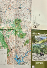
This fold out map and guide will help you discover the wide variety of outstanding recreational opportunities available in the Henry Mountains in central Utah, and surrounding areas.
One side has a topographic map of the area showing roads, trails, campgrounds, points of interest and more.
The map coverage is from Goblin Valley north of Hanksville to the Halls Crossing Marina on Lake Powell to the south; the Maze district of Canyonlands on the east, and the Capitol Reef National Park and the western portion of Dixie National Forest on the west.
The other side has information on the flora and fauna, geology, and history of this remote area along with recreational opportunities that are in the area.
Published by The Bureau of Land Management, Henry Mountain Resource Area 4.
Size: 9 x 4 inches folded, 20 x 18 inches unfolded
#3475


