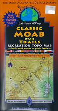
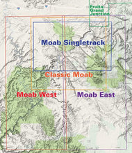
Great recreation topo map of the Moab Area. Covers from the western half of the La Sal Mountains on the east, to Canyonlands Island in the Sky on the west, to Canyon Rims Recreation Area on the south, Klondike Bluffs on the North. Includes UTM, Lat/Long grid, 36 trail/route descriptions, GPSed trails and roads; mileages and artings.
Waterproof/tear resistant. 8th Edition, 2022. Scale: 1:52,500
Map Coverage
- North - Klondike Bluffs
- South - Canyon Rims Recreation Area
- East - La Sal Mountains
- West - Island in the Sky
Size: 39 x 25 inches flat, 8 x 4 inches folded
#2569


