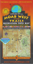
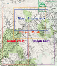
Great recreation topo map with Moab area biking trails, 4WD routes and hiking trails. Covers Moab and the area west of Moab to the Green River, Arches National Park and all three districts of Canyonlands National Park. UTM, Lat/Long grid. 45 trail/route descriptions, 32 elevation profiles. GPS trails & roads; mileages and ratings.
Water proof/tearproof. Scale: 1:75.000 5th Edition (2018).
Map Coverage
- North - 2 miles south of I-70
- South - 6 miles south of Beef Basin - the northern Abajo Mountains
- East - Moab
- West - The entire White Rim Trail
Size: 39 x 25 inches flat, 8 x 4 inches folded
#694


